No structures have been lost. No injuries have occurred on the fire.
Fire control objectives include protection of the Trout, Lee and Kyle communities.
There are 18 crews on scene, 8 of which are Type 1 Hotshot crews, the most highly trained. The Hotshot crews we have are the same type as the crew recently lost in Arizona.
There are the following air assets on the fire:
- 7 helicopters
- 4 heavy air tankers
- 39 engines
- 10 water tenders
- 18 hot shot crews
- VLAT (Very Large Air Tanker. Based on a DC-10). It can drop 11,700 gallons per load.
Fire is located in some very rugged and in inaccessible areas. Engines and other motorized vehicles have limited access.
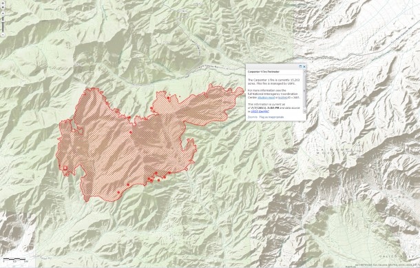
Perimeter (red lines)
MODIS hot spot from satellite sensor, estimated location (1km). (Red Dots)
Source: ESRI http://www.esri.com/services/disaster-response/wildlandfire/user-maps
View Map: http://tmappsevents.esri.com/website/wildfire-responsive/index.html
