GPS Position: N36o 01.136, W115o 33.696 (WGS 84)
Lovell Canyon is located about 25 miles West of Las Vegas at the southern tip of the Spring Mountain Range. Lovell Canyon is situated near the historic Spanish Trail. Stretching from New Mexico and California, the trail was a principal means of reaching the Pacific Coast by Spanish traders. Later the Trail became Nevada’s first route of commerce in 1829 when trade was initiated between Santa Fe and Los Angeles. The trail was later used by the wagons of the “49ers” and Mormon pioneers. Old cabins and mining camps are dispersed around the entire area.
To visit Lovell Canyon from Las Vegas travel north on I-15 to the Blue Diamond/Pahrump exit. Turn right (W) onto State Route 160. Follow this route over Mountain Springs Pass for 24 miles (passing the Potosi Mtn turnoff en route) to the signed, paved, Lovell Canyon road. Turn right (N) and follow this narrow road into Lovell Canyon.
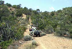
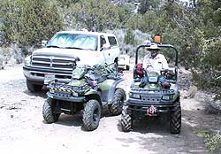
At the 7.5 mile point along the Lovell Canyon road, there is a large camping area immediately across from the Rocky Gap road turn-off marked by a small sign “549” just off the pavement. This is a good place to off-load ATVs etc. or to camp. Off-road vehicles may continue on Rocky Gap road to the Red Rock Summit.

Lovell Canyon
Further North in Lovell Canyon there are many other off-road trails to find and explore. It is recommended to obtain a map of the area to locate the trails.
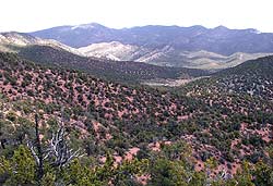
A view to the East across the Lovell Canyon Valley. The Spring Mountains are in the distance.
Tags: camping, Lovell Canyon, Spanish Trail, trail


Is there a community in Lovell Canyon?
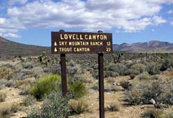
On 12/21/22, I drove up LC Rd to the end of the pavement. At that point there is a chain across the road and signs saying Posted, Stf out. There is also a sign indicating that the L C summit trailhead is a short distance and that Trout canyon is 12 miles up the same snow covered dirt road. I am courious where the power poles that followed LC Rd go, I’ll be back when the snow clears. It really is a beautiful drive.