Category: Mt. Charleston

Carpenter 1 Fire Update- Day 10- 25K+ Acres Burned 10:45 am

July 10, 2013
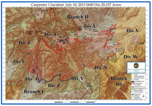
Carpenter 1 Fire New Map Released

Carpenter 1 Fire New Map Released - Click to View

Carpenter 1 Wildfire Update: Wednesday, July10, 2013 9:00 a.m.

Fire activity increased on Tuesday from southwest winds gusting up to 30 mph. The fire pushed northeast, through Harris Springs and Prospect Springs onto Bureau of Land Management property. An additional 5,767 acres burned, one commercial structure and five others were lost on the Prospect Ranch. The fire slopped north across Kyle Canyon Road around Mile Marker 6, east of Harris Springs Road. Dozers, engines and hand crews worked late into the night to stop the fire growth in this location. Overnight burnout operations on Tuesday brought a blackened line to the edge of the Rainbow Subdivision. On Tuesday, helicopters flew more than 43 hours and dropped 162,000 gallons of water on the fire. Four Single Engine Air Tankers (SEATS) each dropped two loads of retardant and the Very Large Air Tanker (VLAT) supported these operations.

Today’s Activity

Additionally, 274 firefighters joined the incident for Wednesday’s shift. Fire managers are expecting another active fire day, with weather conditions similar to Tuesday. Firefighters are working with dozers to build containment lines around the 3-400 acre slopover across Kyle Canyon Road. Large helicopters will support this operation with water and retardant drops. Hot Shot crews will work to strengthen the containment lines on the west side of the fire, above Lee Spring. On the north side of the fire, by Rainbow Subdivision, crews will continue to strengthen the fire edge near Cathedral Rock.

Strategic burnout operations will continue in Lovell Canyon, moving to the northeast. The fire has burned into lighter fuels and flatter terrain on this eastern side, and fire managers are optimistic about containing this fire edge and further securing the Prospect and Harris Ranch areas.

Current Situation

Total Personnel 1,077
Size 25,524 acres
Percent Contained 10%
Fuels Involved Pinyon Juniper
Fire Behavior Running fire behavior with short crown runs. Group tree torching and spotting.
Significant Events The Great Basin Incident Management Team #2 assumed command of the Carpenter 1 Fire at 0600 on Sunday, July 7.
Posted by: Vegas Info      catagory Hiking, Mt. Charleston comments Leave a comment

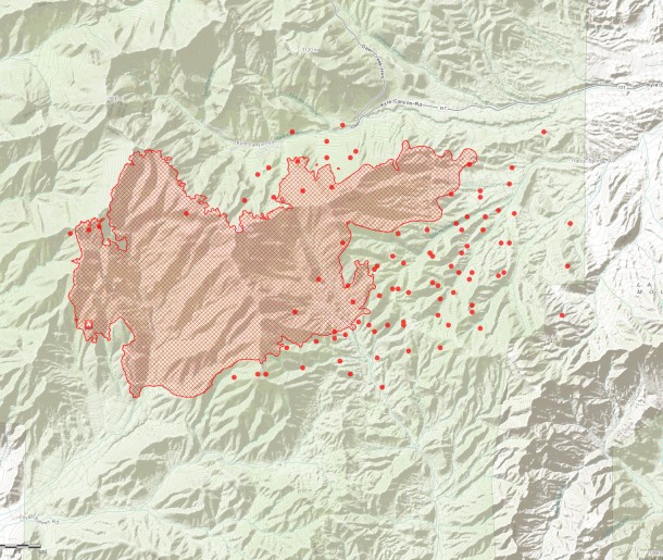
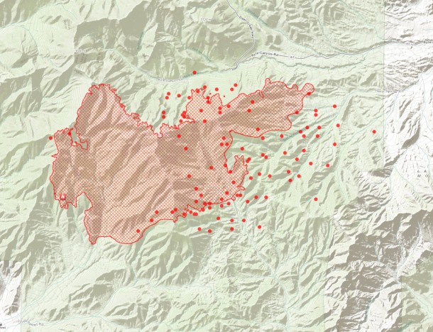
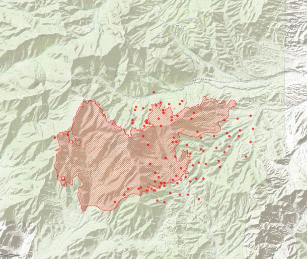
Carpenter 1 Fire Day 10 Hot Spot Map 7:30am

Carpenter 1 Fire Mt. Charleston 7/10/2013 7:30am Click to View Larger Map

Carpenter 1 Fire Mt. Charleston 7/10/2013 7:30am Click to View Larger Map

Carpenter 1 Fire Mt. Charleston 7/10/2013 7:30am

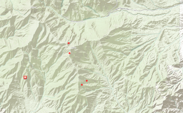
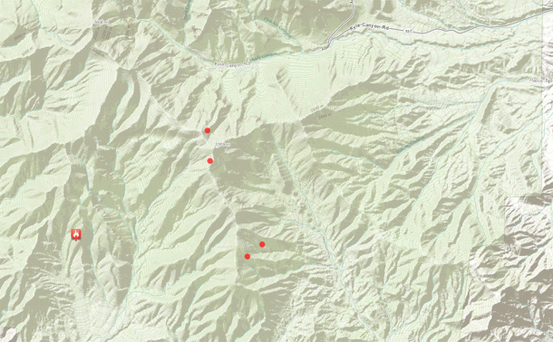
Hot Spot History - Carpenter 1 Fire Mt. Charleston 7/10/2013 7:30am Click to View Animation

Posted by: Vegas Info      catagory Hiking, Mt. Charleston comments Leave a comment

Carpenter 1 Fire Update 4:38pm New Hotspot Map

July 9, 2013
carpenter1fire7-9-2013-1613pm

Carpenter 1 Fire Hotspot Map 7-9-2013-1613pm Click to View Larger Map

Carpenter 1 Fire Animation

Carpenter 1 Fire Hotspot Animation July 7-9th - Click to View Animation

Posted by: Vegas Info      catagory Hiking, Mt. Charleston comments Leave a comment

Carpenter 1 Fire Update- Day 9- Almost 20,000 Acres Burned 11:19 am

carpenter1fire7-9-2013-0730am

Carpenter 1 Fire at Mt. Charleston 7/9/2013 0730am- Click to View Larger Map

Fire Facts

Date started: July 1, 2013
Location: Spring Mountains National Recreation Area, W Las Vegas, Nev.
Size: 19,757 acres
Percent contained: 15%
Cause: Lightning
Structures lost: 0
Number of Personnel: 803
Crews: 19
Engines: 44
Dozers: 2
Water Tenders: 10
Helicopters: 9
Injuries: 0
Cost: $4.84 million

Posted by: Vegas Info      catagory Hiking, Mt. Charleston comments Leave a comment

Carpenter 1 Fire at Mt. Charleston July 8, 2013 8:00pm

July 8, 2013
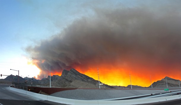
Mt. Charleston Carpenter 1 Fire july 8, 2013

Mt. Charleston Carpenter 1 fire from Summerlin July 8, 2013 8pm – Click to view larger image.

Sun setting behind Carpenter 1 fire on Monday Night 7-8-2013. Photo Taken from top of Lake Mead Blvd and 2-15. Wind direction is blowing towards the northeast bringing the smoke closer to the Las Vegas Valley. additional info

Photo By: LasVegas360.com

Posted by: Vegas Info      catagory Hiking, Mt. Charleston comments Leave a comment

Mt. Charleston Carpenter 1 Fire Update 5:30pm

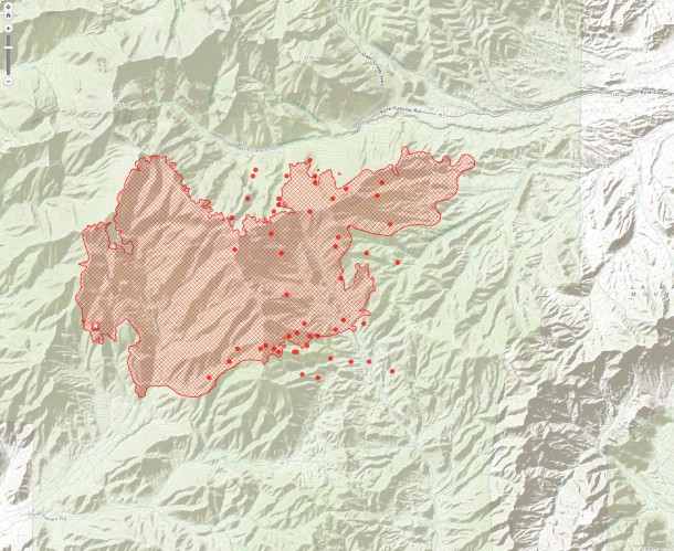
carpenterfire-7-8-2013-1728

Mt. Charleston Carpenter 1 Fire as of 5:28PM 7/8/2013 - Click to View Larger Map

Total Personnel 753
Size 15,268 acres
Percent Contained 15%

Perimeter (red lines)

MODIS hot spot from satellite sensor, estimated location (1km). (Red Dots)

Source: ESRI http://www.esri.com/services/disaster-response/wildlandfire/user-maps
View Map: http://tmappsevents.esri.com/website/wildfire-responsive/index.html

Posted by: Vegas Info      catagory Hiking, Locals, Mt. Charleston comments Leave a comment