Category: Off The Beaten Path

Lovell Canyon, Nevada

July 12, 2011

GPS Position: N36o 01.136, W115o 33.696 (WGS 84)

Lovell Canyon is located about 25 miles West of Las Vegas at the southern tip of the Spring Mountain Range. Lovell Canyon is situated near the historic Spanish Trail. Stretching from New Mexico and California, the trail was a principal means of reaching the Pacific Coast by Spanish traders. Later the Trail became Nevada’s first route of commerce in 1829 when trade was initiated between Santa Fe and Los Angeles. The trail was later used by the wagons of the “49ers” and Mormon pioneers. Old cabins and mining camps are dispersed around the entire area.

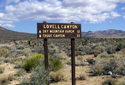
Lovell Canyon

To visit Lovell Canyon from Las Vegas travel north on I-15 to the Blue Diamond/Pahrump exit. Turn right (W) onto State Route 160. Follow this route over Mountain Springs Pass for 24 miles (passing the Potosi Mtn turnoff en route) to the signed, paved, Lovell Canyon road. Turn right (N) and follow this narrow road into Lovell Canyon.

Rocky Gap

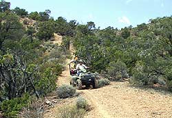
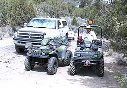
At the 7.5 mile point along the Lovell Canyon road, there is a large camping area immediately across from the Rocky Gap road turn-off marked by a small sign “549” just off the pavement. This is a good place to off-load ATVs etc. or to camp. Off-road vehicles may continue on Rocky Gap road to the Red Rock Summit.

Lovell Canyon

Further North in Lovell Canyon there are many other off-road trails to find and explore. It is recommended to obtain a map of the area to locate the trails.

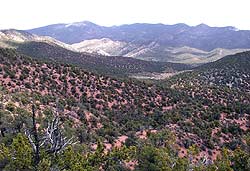
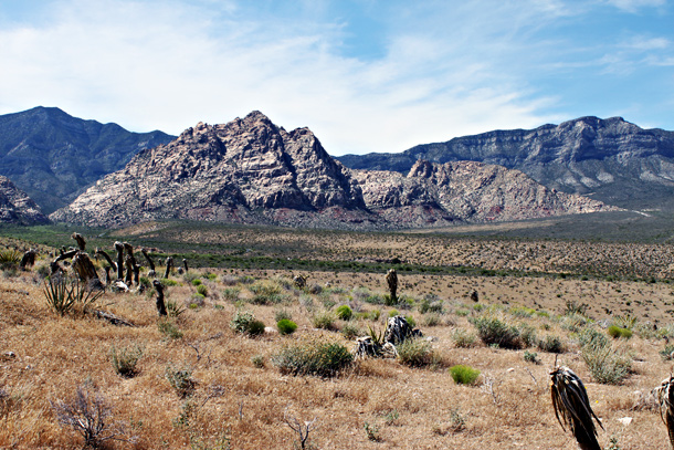
Lovell Canyon Valley

A view to the East across the Lovell Canyon Valley. The Spring Mountains are in the distance.

Road map for this trip

Posted by: Webmaster      catagory Way Off the Beaten Path comments 2 Comments

Rhyolite Ghost Town – Nye County, Nevada

July 11, 2011

GPS: N36° 53.884′ W116° 49.781′ (WGS 84)

Rhyolite was born in 1905 and was once the third largest city in Nevada. The town reached a population of over 10,000 by 1908. Gold was discovered in the hills surrounding the town which was part of one mining stampede after another in Nevada. There are numerous ruins and relics scattered throught the area including a bank, school house, jail and railroad depot. There are also a few intact structures used by a small number of present day residents. There is also present day gold mine located near Rhyolite which ceased operations in 1998. The tailings from the mine just about overshadow the town. For more information about Rhyolite, please refer to http://www.ghosttowns.com/states/nv/rhyolite.html

To get to Rhyolite from Las Vegas, travel Northwest on US 95 for 116 miles (2 hours, 45 minutes) to Beatty, Nevada and turn West on SR 374. Rhyolite is located about 4 miles west of the town of Beatty, Nevada on HWY 374. Signs will guide your way. The trip time is about 3 hours.

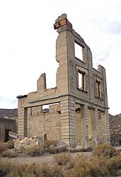
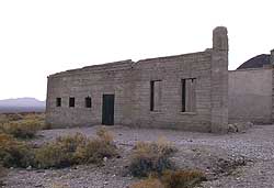
Rhyolite Cook Bank

This is the Cook Bank, which was eventually absorbed by the First Rhyolite National Bank. A United States Post Office was also located in the basement and operated there until 1919. It was the last business to close in Rhyolite. And that was quite a task for the Post Office, because they were selling parts of the Cook Bank Building in 1910!

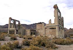
Rhyolite

A full view of the bank. It’s one of the largest buildings still standing in Rhyolite.

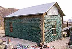
Bottle House

One of the first buildings you will see is the Bottle House. There is register, free information and a tour guide booklet of the town. Be prepared to spend about 15 or 30 minutes with the caretaker, he is a BLM Volunteer who loves to give tours around the Bottle House.

Rhyolite

One of few buildings in the area with an intact roof.

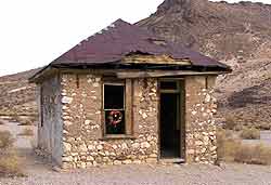
Jail was built in 1907

The jail was built in 1907 out of concrete with four steel cells.

Directions to Rhyolite


Posted by: Webmaster      catagory Off The Beaten Path, Way Off the Beaten Path comments 1 Comment

Boulder City / Hoover Dam

July 4, 2011

Boulder City

Boulder City was built by the federal government to house the thousands of workers who were building the Hoover Dam project in the 1930s. In order to keep these workers away from the temptations of Las Vegas, Boulder City was founded and gambling was made illegal. This quaint town remains the only community in Nevada were gaming is still illegal.

Management and maintenance crews of Hoover Dam are now the predominant residents of Boulder City. This unique town is a vibrant community, with a movie theater, numerous gift shops, parks and a historic hotel. Call the Boulder City Chamber of Commerce for more information 702.293.2034

Hoover Dam
Hoover Dam- is one of the seven man-made wonders of the world. The dam is 727 feet high (70 stories) and 660 feet thick. Construction of the dam required 4.4 million cubic yards of concrete (which is enough to build a two lane highway from San Francisco to New York). In 1928 Congress appropriated $165 million in funds to build the Boulder Dam project for two purposes: flood control and the generation of electricity. Originally called Boulder Dam, it was renamed for Herbert Hoover, Secretary of Commerce, during the critical planning stages of the project. Completed in 1935, this gravity dam holds back the mighty Colorado River and forms the largest man-made lake, Lake Mead. Hoover Dam is located 40 miles from Las Vegas on Highway 93. Tours are available and they leave every few minutes from the exhibit building at the top of the dam. Regular Tours daily from 8-5:15pm Call (702) 293-8367

Lake Mead National Recreation Area
Lake Mead is the largest man-made lake in the country. It is created by Hoover Dam holding back the waters of the Colorado River. Its surface covers 229 square miles and its irregular shoreline extends 550 miles. Lake Mead is located off of Highway 93. The National Park Service can give you details on the lake’s recreational activities and facilities. (702) 293-8990


Posted by: Webmaster      catagory Boulder City-Hoover Dam, Off The Beaten Path comments Leave a comment

Valley of Fire

One of the most beautiful features of the desert are the brillant red rocks that are scattered throughout southern Nevada. These vivid hues can be best observed in the appropriately named, Valley of Fire.

Looking across the barren, hot, desert valley it is hard to believe that 600 milion years ago the entire area was under water. Animal and plant life was abundant here at that time and as the waters subsided over the next 400 million years the thriving ocean floor became a unique desert valley. The sandstone rocks vary in color from deep reds and purples to tans and whites and their unique formations have been formed by millions of years of erosion, wind and climatic change.

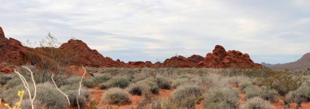
Some of the most interesting rock formations are the “Seven Sisters” which are seven unusal rock formations which stand in a row. They are remnants from the harsh erosion which has changed their shape over the years.

Ancient and Modern Man in the Valley of Fire

To look at this harsh desert landscape it is difficult to believe that ancient people once thrived here. Evidence of their lifestyle has been left behind in petroglyphic drawings. A few archaelogists believe that people lived here as long ago as 15,000 years although that assumption has been unproven most would agree that man was present here about 4,000 years ago. Small enclaves of families roamed and hunted in this area. Their main diet consisted of bighorn sheep and smaller game such as rabbits and tortoises. The first record of Europeans in the area was when the famous mountain man Jedediah Smith, who led the first party of fur trappers into the area in 1826. He was followed by Kit Carson in the 1840s. Just like a tale from an old western movie the Europeans and the Paiute people who had inhabited this area fought over the ownership of the land and its animals.

Mouse’s Tank

One of the greatest legends of the Valley of Fire is about a Paiute Indian named Mouse. Mouse was a known outlaw who worked on ferry that crossed the Colorado River. After a drunken episode where he shot up an Indian camp his employers fired him and dumped him off in Arizona. There, it is said, he killed two prospectors. A intensive search was conducted but Mouse could not be found. Apparently during these episodes Mouse would flee to the Valley of Fire to hide out. Here he would sometimes use “Mouse’s Tank”, a depression in the rocks that catches and holds rainwater for a time after storms. Mouse’s Tank is well hidden within the maze of rock formations on the Petroglyph Canyon floor, a perfect hideout for a fugitive. On July 11, 1897 a posse tracked Mouse near Muddy Spring and ordered him to surrender. Mouse would not give up and after a gun fight with the law Mouse was shot and killed.
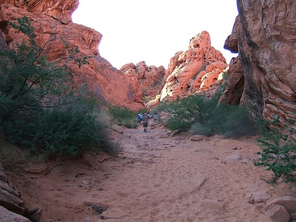
On the trail to Mouse’s Tank

Valley of Fire located 55 miles from Las Vegas it spans more than 37,000 acres. Nevada’s first state park, composed of stunning red sandstone formations and a wealth of Indian artifacts and petroglyphs. A vistors’ center provides information on the park’s history and geology. The Lost City Museum is located nearby. Valley of Fire Vistor Center: (702) 397-2088.

Posted by: Webmaster      catagory Off The Beaten Path, Valley of Fire comments Leave a comment

Mount Charleston / Lee Canyon

Click for Hi-Res 360: Lee Canyon: Mt. Charleston

Mount Charleston / Lee Canyon

The secret to keeping cool during the hot summer months is a trip to Mount Charleston, 45 miles north west of Las Vegas, take Highway 95, turn off onto Highway 157 at Kyle Canyon. Temperatures here average 20 to 30 degrees cooler than the city.

Located in the Toiyabe National Forest in Nevada. Mount Charleston stands at 11,918 feet and offers a tranquil contrast to the excitement and high energy of Las Vegas.The Mount Charleston Wilderness contains 18,000 acres of bristlecone pine, the most extensive stand of these ancient trees in the Intermountain Region. Its high, cool forested mountain landscape is in sharp contrast to the surrounding desert landscape, much like an oasis. There are numerous outdoor activities here such as horseback riding, hiking, camping and picnicking. Call the U.S. Forest Service for more information. 702.873.8800

For overnight accommodations indoors, try the Mount Charleston Hotel, at 2 Kyle Canyon Road. This hotel offers 60 rooms, 3 suites, a lounge, restaurant and a gift shop. 702.872.5500

About 4 miles away, the Mount Charleston Restaurant and Lounge offers hot food in typical mountainside fashion with a wood fireplace and picture windows looking out to the mountains. The restaurant has video slots, and a German polka band performs in the lounge on weekends and holidays.1 Oak Park Road 702.386.6899


Posted by: Webmaster      catagory Mt. Charleston, Off The Beaten Path comments Leave a comment

Red Rock Canyon

Click for Hi-Res 360: Red Rock Canyon

Click to view hi-res photo 360: Red Rock Canyon

Red Rock National Conservation Area

To observe the true beauty of the high desert you should make the trip to Red Rock National Conservation Area. Head west on Charleston Boulevard about 16 miles from Las Vegas. The Bureau of Land Management operates a visitors’ center where they exhibit plant, animal and desert life. Don’t miss the drive around the 13 mile scenic loop (toll booth payment required) as it winds through the colorful red rocks, Joshua trees and the unusually beautiful desert scenery.

White Rock in Red Rock Canyon

White Rock in Red Rock Canyon

White Rock in Red Rock National Conservation Area. This is a good hike to do on cooler days. View White Rock Loop Hike

Photos by: LasVegas360.com

Posted by: Webmaster      catagory Hiking, Off The Beaten Path, Red Rock comments Leave a comment